

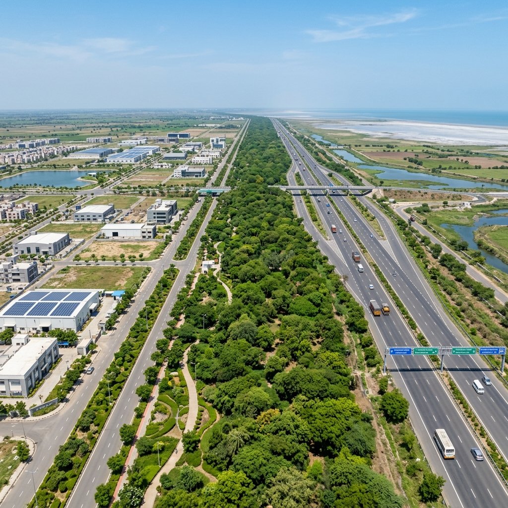
1. Roadside Green Buffers & Environmental Barriers
To control noise, absorb particulate air emissions, and improve city aesthetics, DSIRDA has designed wide green belts along major transit routes:
- Arterial Road Buffers: Major highways and roads, such as the 55-meter and 70-meter wide roads, feature dedicated green buffer zones measuring 10 to 20 meters wide on both sides of the roadway.
- Industrial-Residential Boundaries: A mandatory buffer zone of up to 50 meters is required between heavy industrial zones (like TP2 electronics blocks) and residential zones. This space is planted with dense trees to block industrial noise and dust.
- Permitted Development: Only light public amenities—including pedestrian walking paths, running tracks, cycle lanes, and buried utility lines—are allowed inside these green buffer strips.
2. The Sabarmati Riverfront Development Setbacks
The Sabarmati River bounds Dholera SIR to the east. To protect the river ecosystem and safeguard development from high flood events:
- 100-Meter Setback Zone: DSIRDA enforces a strict 100-meter buffer zone from the High Flood Line (HFL) of the Sabarmati River. Within this zone, no permanent residential, commercial, or industrial structures are allowed.
- Coastal Regulation Zone (CRZ) Adherence: The river buffer works in coordination with CRZ laws to prevent construction on salt pans, mudflats, and low-lying coastal areas.
- Riverfront Parks & Landscaping: The riverfront setback is designed to house public parks, biodiversity reserves, and water storage ponds to capture stormwater runoff during monsoon periods.
The table below lists the buffer zone specifications under DSIRDA GDCR:
| Buffer Zone Category | Minimum Required Width | Permissible Uses | Prohibited Activities |
|---|---|---|---|
| **Sabarmati Riverfront** | 100 Meters (from HFL) | Public gardens, check dams, walking paths | Any permanent concrete buildings |
| **70-Meter Arterial Road** | 20 Meters (both sides) | Cycle tracks, landscape turf, utility pipelines | Retail shops, parking structures |
| **55-Meter Arterial Road** | 10 – 15 Meters | Street tree planting, streetlights, pathways | Commercial billboards, building entries |
| **Industrial / Residential Zone Interface** | 30 – 50 Meters | Dense tree canopies, acoustic earth mounds | High-density housing, factory extensions |
3. Long-Term Value for Investors
For plot buyers and real estate developers in Dholera SIR, these green buffers provide key value:
- Guaranteed Open Space: The zoning ensures that residential townships will not be encroached upon by factories, protecting property values.
- Enhanced Quality of Life: Paved walkways and parks within the green buffers create healthy, walkable residential neighborhoods.
- Natural Stormwater Management: The green buffers absorb heavy monsoon rain, reducing local street flooding.
Frequently Asked Questions (FAQ)
#### What is the green buffer zone along the Sabarmati River in Dholera?
Under DSIRDA regulations, a strict 100-meter no-construction buffer zone is enforced from the High Flood Line (HFL) of the Sabarmati River to protect the riverfront and prevent flood risks.
#### What can be built inside a green buffer in Dholera SIR?
No permanent buildings can be constructed. Permitted activities are limited to landscaping, tree planting, pedestrian walkways, bicycle paths, public parks, and underground utility corridors.
#### How much of Dholera Smart City is reserved for green spaces?
Under the smart city master plan, approximately 12% of the 422 sq. km planned developable area is reserved for green buffers, recreational parks, and open space corridors.
Download Dholera SIR 2026 Investor’s Kit
Get instant access to the official planning documents: Dholera Investment Handbook (PDF), 2026 Land Price List, TP Zone & Village Map, and the NRI Buying Guide.

Join The Discussion