

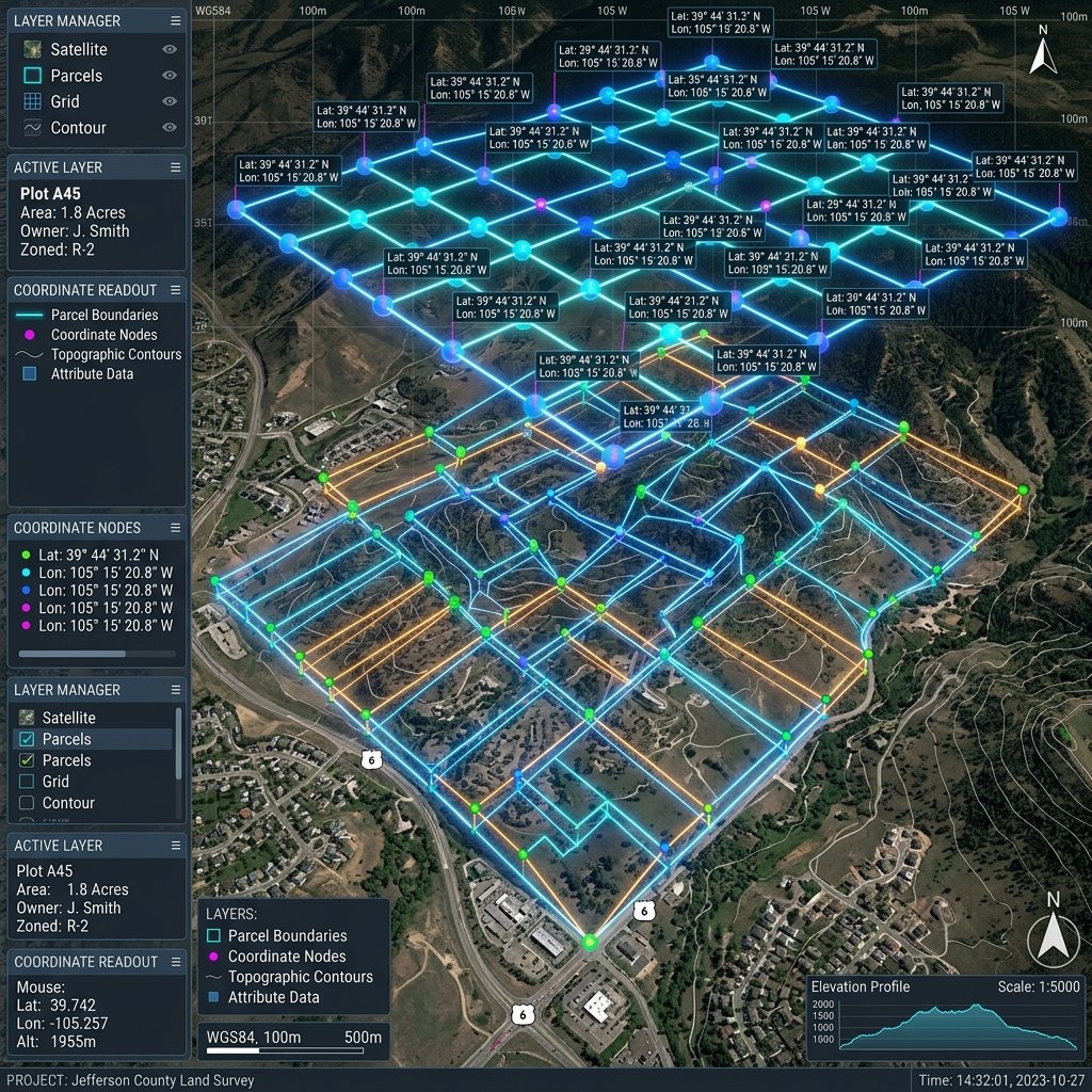
1. The GIS Mapping Infrastructure in Dholera
DSIRDA, in partnership with Gujarat State Space Applications Group (GYSAG), mapped the entire region of Dholera SIR before initiating the town planning layouts:
- Geodetic Reference Frame: All survey data is mapped using the WGS-84 (World Geodetic System 1984) coordinate reference system, projected onto the UTM Zone 42 North grid.
- Establishment of Control Points: Over 250 permanent concrete geodetic control stations were built across Dholera to serve as absolute coordinate benchmarks for land surveyors.
- DGPS Verification: Standard satellite GPS receivers have a margin of error of several meters. DSIRDA mandates the use of Differential GPS (DGPS) ground-based reference corrections, bringing coordinate margin of error down to less than 15 millimeters.
2. Reading Plot Coordinates via F-Forms (Form-F)
During the Town Planning (TP) scheme reconstitution process, every land parcel’s transition from an Original Plot (OP) to a Final Plot (FP) is logged in a legal document called the F-Form:
- Coordinate Schedules: The F-Form contains a dedicated section showing the exact physical coordinate coordinates (Latitude/Longitude or Northing/Easting coordinates) of every vertex of the allocated Final Plot.
- Corner Boundary Verification: When purchasing private land or verifying a plot allotment, buyers should hire a licensed surveyor to run a DGPS survey using the coordinate list on the F-Form.
- Cross-Checking GIS Layers: The survey results are compared to the official DSIRDA Town Planning Scheme GIS database, ensuring that the physical plot layout matches the digital layout.
The table below lists the coordinate and surveying parameters enforced by DSIRDA:
| Technical Parameter | Standard Specification | Purpose / Application |
|---|---|---|
| **Coordinate Datum** | WGS-84 / UTM Zone 42N | Standard geodetic model for global GPS positioning |
| **Surveying Technology** | DGPS (Differential GPS) & RTK | Centimeter-level land parcel boundary verification |
| **Max Permissible Tolerance** | +/- 15 Millimeters | Prevents adjacent plot overlaps and layout disputes |
| **Reference Document** | F-Form (Form-F Schedules) | Contains vertex coordinates for Final Plots (FPs) |
| **GIS Coordination Authority** | DSIRDA & BISAG Gujarat | Management of digital land record layers |
3. Critical Due Diligence for Land Buyers
Verifying boundary coordinates is an essential checklist step for real estate investors:
- Overlap Verification: Coordinate verification confirms that the plot does not overlap with road alignments, green buffers, or neighboring property lines.
- Physical Boundary Marker Audits: Developers must place concrete survey markers at the exact coordinate coordinates of the plot corner points.
- Infrastructure Setback Checks: Verifying coordinates confirms that the plot matches the required margins and setbacks from utility corridors and pipeline networks.
Frequently Asked Questions (FAQ)
#### How can I find the boundary coordinates of my Dholera plot?
The exact boundary coordinates of your plot are detailed in the official F-Form (Form-F) document under the Town Planning (TP) scheme schedule. You can also view plot boundaries via the DSIRDA GIS portal.
#### What GPS system is used in Dholera SIR?
Dholera SIR utilizes the WGS-84 geodetic reference system with Universal Transverse Mercator (UTM Zone 42N) projections. Physical land boundary surveys require DGPS (Differential GPS) receivers to achieve sub-centimeter accuracy.
#### Why is coordinate boundary check important when buying land?
Coordinate check ensures that the physical boundaries of the plot match the government’s official land records, preventing potential boundary overlaps with adjacent plots or planned public infrastructure.
Download Dholera SIR 2026 Investor’s Kit
Get instant access to the official planning documents: Dholera Investment Handbook (PDF), 2026 Land Price List, TP Zone & Village Map, and the NRI Buying Guide.



Join The Discussion