

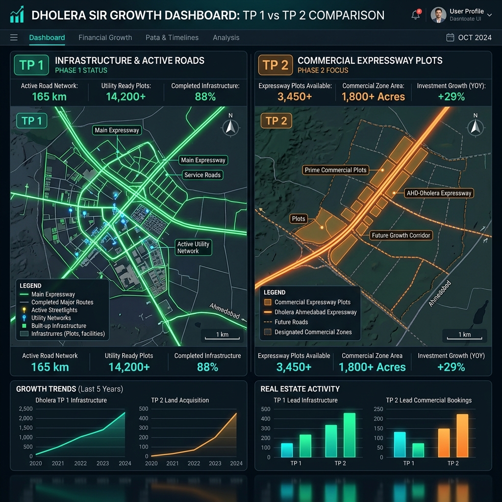
> Dholera SIR allocates land through the Town Planning (TP) scheme model, applying a standard 40% to 50% land deduction on Original Plots (OP) to build public infrastructure. The remaining reconstituted area is returned to owners as a Final Plot (FP) with clear titles and immediate zoning permissions.
How the Dholera TP Scheme Land Allotment Model Works
The reconstitution process converts raw agricultural land parcels into fully serviced urban plots through a legal, multi-step allotment process.
The Original Plot (OP) to Final Plot (FP) Transition
- Original Plot (OP): This is the raw, agricultural land parcel owned by the original farmer or developer before the implementation of the Town Planning Scheme.
- Deduction (40% to 50%): The government (DSIRDA) deducts a portion of the raw land—typically 40% to 50%—to construct roads, parks, smart utility canals, schools, and sewage treatment plants.
- Final Plot (FP): The remaining 50% to 60% of the land is returned to the owner. This reconstituted parcel is the Final Plot (FP), which benefits from direct road access, clean boundaries, and designated zoning (residential, commercial, or industrial).
| Reconstitution Metric | Standard TP Specification | Investor Significance |
|---|---|---|
| Land Deduction Rate | 40% to 50% of Original Plot | Public infrastructure footprint |
| Reconstitution Return | 50% to 60% as Final Plot | Title clear, serviced land |
| Allowed Floor Space Index | FSI of 1.0 to 5.0 (Zone dependent) | Development density potential |
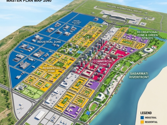
| Zoning Classifications | Residential, Commercial, Industrial | Legal land-use boundary |
Developer Plot Schemes vs. Government Allotments
When investing in a Dholera plot scheme, it is vital to distinguish between government allocations and private projects.
- Government Land Allotments: Housed within the ABCD Building, DICDL manages direct industrial and commercial land allotments. These allotments are reserved for large manufacturing units, tech parks, and corporate hubs.
- Private Developer Schemes: Private developers purchase finalized Final Plots (FPs) from local landowners and subdivide them into smaller residential or commercial layouts. To be legal, these subdivided schemes must obtain separate layout approvals from DSIRDA and register under GujRERA.
- Verification of Allotment: Always inspect the Form F (reconstitution document) issued by the Town Planning Officer (TPO). This document maps the exact boundaries and coordinates of the Original Plot (OP) to the Final Plot (FP).

Zoning Options Near Key Infrastructure Corridors
Understanding where a plot scheme falls within the master plan determines its rate of capital appreciation:
- Town Planning Scheme 1 (TP 1): The Activation Area, which is already fully developed with Torrent Power smart grid hookups. Focus on verified commercial plots near the main logistics nodes.
- Town Planning Scheme 2 (TP 2): Home to the main High Access Corridor (HAC) along the expressway. Explore our verified plots in Mahadevpura-HAC (ID 2719) for premium commercial development.
- Town Planning Scheme 3 (TP 3): Surrounding the upcoming Dholera International Airport. Check our verified listing in Navagam-Airport (ID 2703) for immediate proximity to the aviation zone.
Frequently Asked Questions (FAQ)
What is Form F in the Dholera TP Scheme?
Form F is the official legal document issued by the Town Planning Officer that shows the exact mapping, area deduction, and final plot allocation from the original land record.
Are plot rates in Dholera SIR regulated by the government?
Government industrial allotments are priced based on base rates set by DICDL. However, private residential and commercial plot rates are determined by market demand, zoning, and proximity to infrastructure.
How much land is deducted in Dholera SIR?
Under the Gujarat Town Planning and Urban Development Act, the government deducts between 40% and 50% of the original land parcel for city-level infrastructure, returning the remainder as a serviced final plot.
Disclaimer: Town planning schemes and reconstitution allocations are subject to finalized maps issued by DSIRDA and the Gujarat Revenue Department. Investors must verify Form F records personally before buying.
Download Dholera SIR 2026 Investor’s Kit
Get instant access to the official planning documents: Dholera Investment Handbook (PDF), 2026 Land Price List, TP Zone & Village Map, and the NRI Buying Guide.

Join The Discussion