

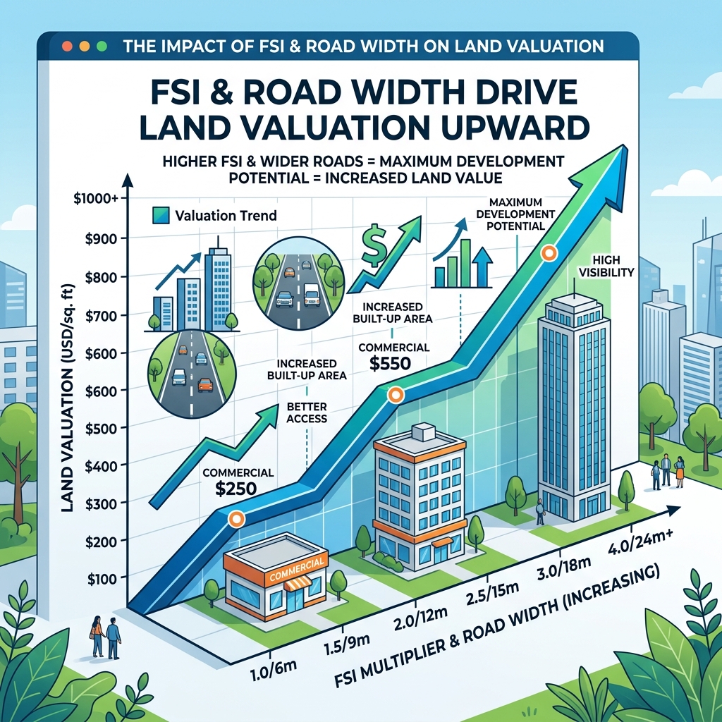
1. Road Width and FSI Multipliers
The primary factor driving land value in Dholera SIR is the width of the road directly serving the plot. Under the DSIRDA GDCR, building height and Floor Space Index (FSI) limits scale based on road widths:
- 9m to 12m Roads: These roads are designated for residential layouts. They carry a base FSI of 1.5 to 1.8, restricting construction to low-rise buildings. Consequently, these plots have lower valuation rates.
- 18m to 30m Roads: These corridors connect commercial and light industrial zones. They support a base FSI of 2.0, allowing for mid-rise structures and driving up valuation.
- 55m and 70m High Access Corridors (HAC): These premium transit roads allow developers to buy additional FSI up to 5.0, enabling high-rise vertical developments. Due to this high development potential, HAC plots command premium market prices and experience higher appreciation rates of 12% to 18% p.a.
2. Core Land Valuation Drivers
Beyond road access, several key parameters influence property values across the town planning schemes:
- Zoning Classification: Industrial plots (regulated by DICDL base allotment rates) are priced differently than residential townships or premium retail commercial zones.
- Reconstitution Status (OP vs. FP): Serviced Final Plots (FP) with clear boundary coordinates verified by Differential GPS (DGPS) command higher valuations than raw agricultural land (Original Plots – OP) that still needs to undergo town planning reconstitution.
- Transit Proximity: Plots situated near Ahmedabad-Dholera Expressway interchanges, the under-construction Metro route stations, or the active TP2 Activation Area are valued higher due to better transit access.
The table below details how valuation factors impact FSI and land prices:
| Valuation Factor / Parameter | Base FSI | Max FSI Option | Typical Annual Appreciation | Market Valuation Trend |
|---|---|---|---|---|
| **Abutting Road < 12m** | 1.5 | 1.5 | 10% – 12% p.a. | Entry-level residential plotted developments |
| **Abutting Road 18m – 24m** | 1.8 | 2.0 | 12% – 14% p.a. | Medium-density commercial & logistics warehousing |
| **High Access Corridor (55m+)** | 3.0 | 5.0 | 12% – 18% p.a. | Premium commercial towers and high-rise apartments |
| **DGPS Serviced Final Plot (FP)** | Depends on Zone | Depends on Zone | 13% – 15% p.a. | Premium due to immediate construction eligibility |
| **Unreconstituted Agri Land (OP)** | N/A | N/A | Variable | Discounted rates due to pending town planning deductions |
3. Infrastructure and Location Factors
- Smart Utility Hookups: Plots with direct connection access to underground utility ducts (providing pre-installed water, sewage, gas, power, and fiber connections) command higher prices than plots in outer zones where utility connections are still being laid.
- Distance to Airport: Plots within the northern schemes (TP1 and TP2) that lie closer to the Dholera International Airport (DIACL) cargo terminal carry higher commercial premiums.
Frequently Asked Questions (FAQ)
#### How does road width affect plot prices in Dholera SIR?
Road width determines the allowed building height and FSI under DSIRDA GDCR rules. Wider roads (such as the 55m and 70m High Access Corridors) allow for higher FSI buy-ups (up to 5.0), making these plots more valuable than those on narrow residential roads.
#### What is the typical land appreciation rate in Dholera?
Standard residential and industrial plots experience appreciation rates of 10% to 15% per annum, while premium commercial plots along the High Access Corridors (HAC) see appreciation rates of 12% to 18% per annum.
#### Why are Final Plots (FP) valued higher than Original Plots (OP)?
Final Plots have already gone through the town planning reconstitution process, which includes standard public infrastructure deductions, verified DGPS boundaries, and immediate construction clearance. Original Plots require conversion and boundary delineation before construction can begin.
Download Dholera SIR 2026 Investor’s Kit
Get instant access to the official planning documents: Dholera Investment Handbook (PDF), 2026 Land Price List, TP Zone & Village Map, and the NRI Buying Guide.

Join The Discussion