
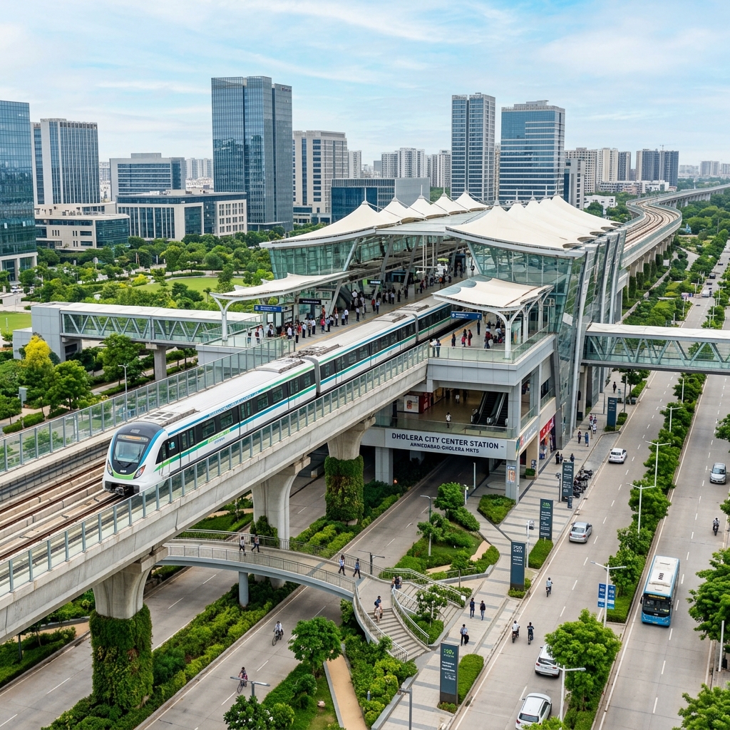
The Ahmedabad-Dholera Metro (MRTS) Corridor
The proposed MRTS line will run parallel to the Ahmedabad-Dholera Expressway within a designated 200-meter utility corridor. This high-speed rail transit system will drastically reduce travel time between Ahmedabad and Dholera to under 45 minutes, facilitating daily commutes for industrial workers, tech professionals, and airport passengers.
Key Transit Milestones:
- Expressway Integration: The metro line runs elevated in the center of the utility corridor bordering the expressway, minimizing land acquisition issues.
- Airport Connection: A dedicated branch line is planned to link the Dholera International Airport terminal directly to the central transit interchanges.
- Multimodal Hubs: Major station nodes are designed to connect with bus rapid transit (BRTS) systems and the semi-high-speed cargo rail line.
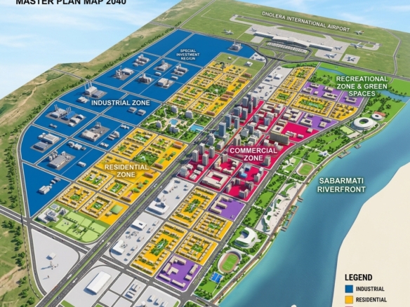
Proposed Metro Station List and Zoning Matrix
The MRTS route inside Dholera SIR features several strategically positioned stations designed to serve key Town Planning (TP) schemes. Here is the verified station zoning map breakdown:
| Metro Station Name | Associated TP Scheme | Proximity to Airport (km) | Allowed TOD FSI | Primary Station-Area Zoning |
|---|---|---|---|---|
| Pipli Junction | TP 1 / Entrance | 18 Km | 3.0 (Base) / 5.0 (Max) | Logistics / Commercial Core |
| Knowledge City Station | TP 1 / Activation | 12 Km | 2.5 (Base) / 5.0 (Max) | IT Parks / Universities |
| Dholera Central Interchange | TP 2 / Expressway | 8 Km | 5.0 (Max) | High-Density Commercial |
| Airport Transit Terminal | TP 3 / Airport Zone | 0 Km | 5.0 (Max) | Hotels / Retail / Lounges |
| Industrial Core South | TP 5 / Manufacturing | 15 Km | 1.8 (Max) | Workers’ Housing / Services |
Transit-Oriented Development (TOD) Zoning Explained
The core philosophy of Transit-Oriented Development is to concentrate commercial activity and high-density housing near transit hubs. DSIRDA has integrated specific TOD guidelines into the Dholera master plan:
- FSI Incentives: Property owners within 500 meters of a metro station can purchase premium FSI up to 5.0, allowing them to build taller commercial buildings and high-occupancy residential complexes.
- Mixed-Use Approvals: TOD zones allow developers to mix retail shops on the ground floors with residential apartments or corporate offices on upper floors, maximizing rental yield potentials.
- Pedestrian-Friendly Corridors: Blueprints require developers to build wider footpaths, cycling tracks, and open public plazas facing the metro stations.
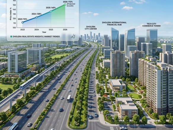
Impact of Metro Connectivity on Plot Prices
Historically, metro corridors in cities like Delhi (NCR) and Bangalore have driven land price appreciation of 30% to 50% along transit routes. In Dholera SIR, the impact will be even higher due to the greenfield nature of the development. Plots within walking distance of the stations in TP 1 and TP 2 are experiencing rapid inquiries from corporate guest house operators and retail developers.
Disclaimer: This article is published by the editorial team at Dholera Acres for informational purposes only. It does not constitute formal financial, legal, or investment advice. While every effort has been made to verify the town planning regulations, FSI rules, and infrastructure timelines with official DSIRDA and DICDL publications, land investments are subject to market risks. Readers are strongly advised to perform independent legal due diligence and consult certified property advisors before making any transaction in Dholera SIR.
Frequently Asked Questions (FAQ)
When will the Ahmedabad-Dholera Metro be operational?
The Ahmedabad-Dholera Metro MRTS project is planned in phases, matching the industrial commissioning of the semiconductor fabs and the international airport. Construction tenders for the initial elevated sections are in the evaluation phase, with target operations aligned with the late 2020s rollout of Phase 2.
What is TOD and how does it benefit a plot owner?
TOD (Transit-Oriented Development) is a zoning model that permits higher FSI and mixed-use development within a close radius of transit stations. For plot owners, it increases land usability, allowing you to construct up to 4 times the plot area, which dramatically increases the land’s valuation and rental potential.
How can I buy a plot within the metro corridor safely?
To buy land within the TOD metro corridor safely, verify the DSIRDA zoning maps to ensure the plot falls within the designated 500-meter buffer zone, confirm the land pooling F-Form, and consult with the land verification experts at Dholera Acres.
Download Dholera SIR 2026 Investor’s Kit
Get instant access to the official planning documents: Dholera Investment Handbook (PDF), 2026 Land Price List, TP Zone & Village Map, and the NRI Buying Guide.

Join The Discussion