

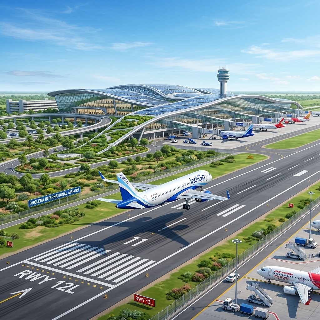
Dholera International Airport: Core Project Specifications
| Project Parameter | Official Engineering Specification / Timeline |
|---|---|
| **Executing Special Purpose Vehicle (SPV)** | **Dholera International Airport Company Limited (DIACL)** |
| **Primary Project Stakeholders** | **AAI (51%), Govt. of Gujarat (33%), NICDIT (16%)** |
| **Total Project Land Area** | **1,426 Hectares (~3,520 Acres)** near Navagam |
| **Phase 1 Capital Outlay** | **₹1,305+ Crore** (Initial Phase) |
| **Runway 1 Dimensions (Phase 1)** | **3,200 Meters Length × 45 Meters Width** (Code 4E Compliant) |
| **Aircraft Compatibility** | Widebody jets including **Boeing 777, 787 Dreamliner & Airbus A350** |
| **Future Runway 2 (Phase 2)** | **4,000 Meters Length** (Parallel runway for long-haul cargo) |
| **Terminal 1 Passenger Capacity** | **1.5 to 3.0 Million Passengers Per Annum (MPPA)** |
| **Air Freight Capacity (Phase 1)** | **100,000 Metric Tonnes Per Annum** specialized cargo hub |
Official Flight Timelines & Opening Schedule
Civil aviation delivery in India follows a multi-stage statutory validation sequence mandated by the Directorate General of Civil Aviation (DGCA) and the Bureau of Civil Aviation Security (BCAS):
“`mermaid flowchart TD A[“Stage 1: Runway Paving & Airfield Lighting Calibration (Completed)”] –> B[“Stage 2: ATC Superstructure & DVOR Navigational Testing (Active)”] B –> C[“Stage 3: AAI Calibration Flight Trials (Mid/Late 2026)”] C –> D[“Stage 4: DGCA Aerodrome Licensing & Security Audit (Late 2026)”] D –> E[“Stage 5: Commercial Cargo Flights & Domestic Passenger Launch (2026-2027)”] “`
1. Airfield & Runway Paving Milestone
The 3,200-meter primary runway features heavy-duty polymer-modified asphalt concrete capable of withstanding high-impact loadings from intercontinental cargo freighters. Ground lighting conduits, threshold markings, and instrument landing system (ILS Category II) arrays are physically installed along the central strip.
2. Air Traffic Control (ATC) & Navigational Radar
The visual ATC tower structure stands prominent at the airfield center, equipped with Doppler VHF Omnidirectional Range (DVOR) and Instrument Landing Systems (ILS) providing precision guidance for low-visibility landings during monsoon or winter weather.
3. Target Commercial Launch Phases
- Late 2026 (Flight Inspection & Cargo Clearance): AAI flight inspection units conduct calibration sorties, leading to initial non-scheduled air cargo operations catering to early semiconductor and industrial component exports.
- Early 2027 (Scheduled Domestic Passenger Operations): Launch of direct commercial routes connecting Dholera to major economic hubs including Delhi, Mumbai, Bengaluru, and Hyderabad, alleviating congestion at Ahmedabad’s Sardar Vallabhbhai Patel International Airport.
- 2028+ (International Freight & Charter Expansion): Full-scale belly and dedicated freighter operations connecting Southeast Asian and Middle Eastern cargo logistics chains.
The Airport Influence Zone (AIZ) & Zoning Dynamics
Aviation infrastructure creates a specialized real estate ecosystem surrounding its perimeter. Under the DSIRDA General Development Control Regulations (GDCR) 2023, the land encircling the airport is master-planned into specific high-yield economic zones:
“` Airport Perimeter Wall ──► Aerodrome Buffer & Flight Path Funnel (Statutory Height Restrictions) ──► High-Density Logistics & Air Freight Parks (TP-3 Logistics) ──► Star Hotels, Convention Centres & Corporate Transit Suites (TP-3 Commercial) ──► Premium Residential Enclaves & Airline Staff Townships (TP-2 & TP-3 Residential) “`
1. Aviation Logistics & Cold Storage Hubs
Because Dholera is engineered as an export-driven smart city, the cargo apron connects directly to dedicated bonded warehousing, cold-chain pharmaceuticals storage, and high-value semiconductor packaging facilities located along the airport boundary road.
2. Hospitality & Business Tourism Corridor
Major hotel chains and convention operators seek land along the primary 55-meter airport access highway to serve incoming corporate delegations, Taiwan/Japanese tech partners, and business travelers visiting the industrial activation area.
To examine the exact geographic boundaries of the airport zone relative to nearby villages, explore our Dholera SIR Boundary Map & Village Master Guide.
Plot Price Rates Across the Airport Influence Zone (2026)
The progression of physical airport civil works has triggered significant capital appreciation across neighboring micro-sectors:
| Micro-Sector / Village Location | Distance to Airport Terminal | Prevailing Rate (₹ / Sq. Yd.)* | 3-Year Appreciation | Primary Development Activity |
|---|---|---|---|---|
| **TP-3 Core Aviation Commercial Corridor** | 2 – 5 km | **₹6,500 – ₹11,000+** | **~110% – 140%** | Transit hotels, logistics headquarters, corporate suites |
| **TP-3 Residential Plotted Layouts** | 5 – 10 km | **₹4,200 – ₹7,000** | **~75% – 95%** | Gated villa layouts, airline crew co-living |
| **Navagam Village Enclave (Entry Spine)** | 6 – 12 km | **₹3,800 – ₹6,200** | **~70% – 85%** | Mixed residential, suburban retail avenues |
| **Kothariya & Otariya Periphery** | 10 – 16 km | **₹2,800 – ₹4,500** | **~65% – 80%** | Emerging plotted expansions, long-term plots |
| **TP-1 Activation Core (Industrial Access)** | 18 – 22 km | **₹9,000 – ₹16,500+** | **~135% – 160%** | High-tech manufacturing, corporate admin towers |
\Rates reflect clear-title Non-Agricultural (NA) Final Plots (FPs) with sanctioned layouts. Stamp duty and registration charges are extra.*
DGCA Height Restrictions: What Every Land Buyer Must Verify
When purchasing land in the Airport Influence Zone, investors must verify that their intended building construction does not violate aviation safety rules:
“`mermaid graph LR subgraph AirportSafety[“DGCA Obstacle Limitation Surfaces (OLS)”] InnerZone[“Funnel & Runway Approach\n(Strict Height Limits: 0m to 15m)”] MidZone[“Inner Horizontal Surface\n(Permissible Height: 15m to 45m)”] OuterZone[“Conical Surface Zone\n(High-Rise Feasible: 45m to 70m+)”] end “`
- Colour Coded Zoning Map (CCZM): The Airports Authority of India issues an official CCZM defining the maximum permissible building height above mean sea level (AMSL) for every survey coordinate surrounding the airport.
- NOC for Building Construction: Any vertical development within a 20-kilometer radius of the Dholera airport reference point requires a formal No Objection Certificate (NOC) from the AAI’s online NOCAS portal.
- Plotted Residential Safety: Standard ground-plus-two duplex residential villas (typically 10 to 12 meters in height) are fully compliant and permissible across residential sectors in TP-2 and TP-3 without requiring complex aeronautical obstacle exemptions.
Browse pre-verified, height-compliant residential plots located within the airport corridor on our active Properties and Plots Portal.
Investment Outlook: 5-Year Capital Growth Projection
Historical land data from international airport corridors across India demonstrates that land prices experience three distinct appreciation inflection points:
- Inception to Land Acquisition: Speculative, volatile growth driven by policy announcements (Dholera 2015–2020: ₹600 to ₹1,500/sq. yd.).
- Civil Execution & Runway Paving: De-risking phase with structural capital deployment (Dholera 2021–2026: ₹2,500 to ₹6,500+/sq. yd.).
- Commercial Flight Operationalization: Exponential jump as executive travel, hotel occupancy, and high-frequency trade commences (Projected 2027–2030+: ₹10,000 to ₹20,000+ per sq. yard along primary access nodes).
Acquiring a legally secure, non-agricultural Final Plot (FP) in TP-3 today positions investors directly ahead of the commercial flight commissioning curve.
Frequently Asked Questions
What is the official opening date for Dholera International Airport?
Civil runway paving and ATC tower installation are at advanced stages in 2026. AAI calibration flights and operational trials are scheduled for late 2026, leading to initial cargo movements and scheduled commercial domestic passenger flight operations in 2027.Will Dholera Airport replace Ahmedabad’s SVPI Airport?
No. Dholera Airport will function as a complementary international aviation hub. While SVPI Airport handles primary regional traffic within Ahmedabad municipal limits, Dholera Airport will handle massive international cargo, widebody long-haul passenger flights, and overflow traffic from central and southern Gujarat.How far is Dholera Airport from Ahmedabad city?
Dholera International Airport is approximately **80 to 90 kilometers** south-west of Ahmedabad, connected directly via the dedicated access-controlled Ahmedabad-Dholera Expressway, enabling drive times of roughly **50 to 60 minutes**.Which Town Planning scheme is closest to Dholera Airport?
**Town Planning Scheme 3 (TP-3)** is the primary Airport Influence Zone, directly adjoining the southern and eastern boundary of the airport complex and earmarked for corporate hospitality, air freight logistics, and planned residential neighborhoods.Can I buy a residential plot right next to the airport boundary?
Directly adjacent parcels are strictly zoned for aviation services, security buffers, and cargo logistics. However, approved residential plotted developments are available starting 3 to 8 kilometers from the terminal along designated 18-meter and 24-meter sector roads in TP-3.JSON-LD Schema Markup
Download Dholera SIR 2026 Investor’s Kit
Get instant access to the official planning documents: Dholera Investment Handbook (PDF), 2026 Land Price List, TP Zone & Village Map, and the NRI Buying Guide.


Join The Discussion