

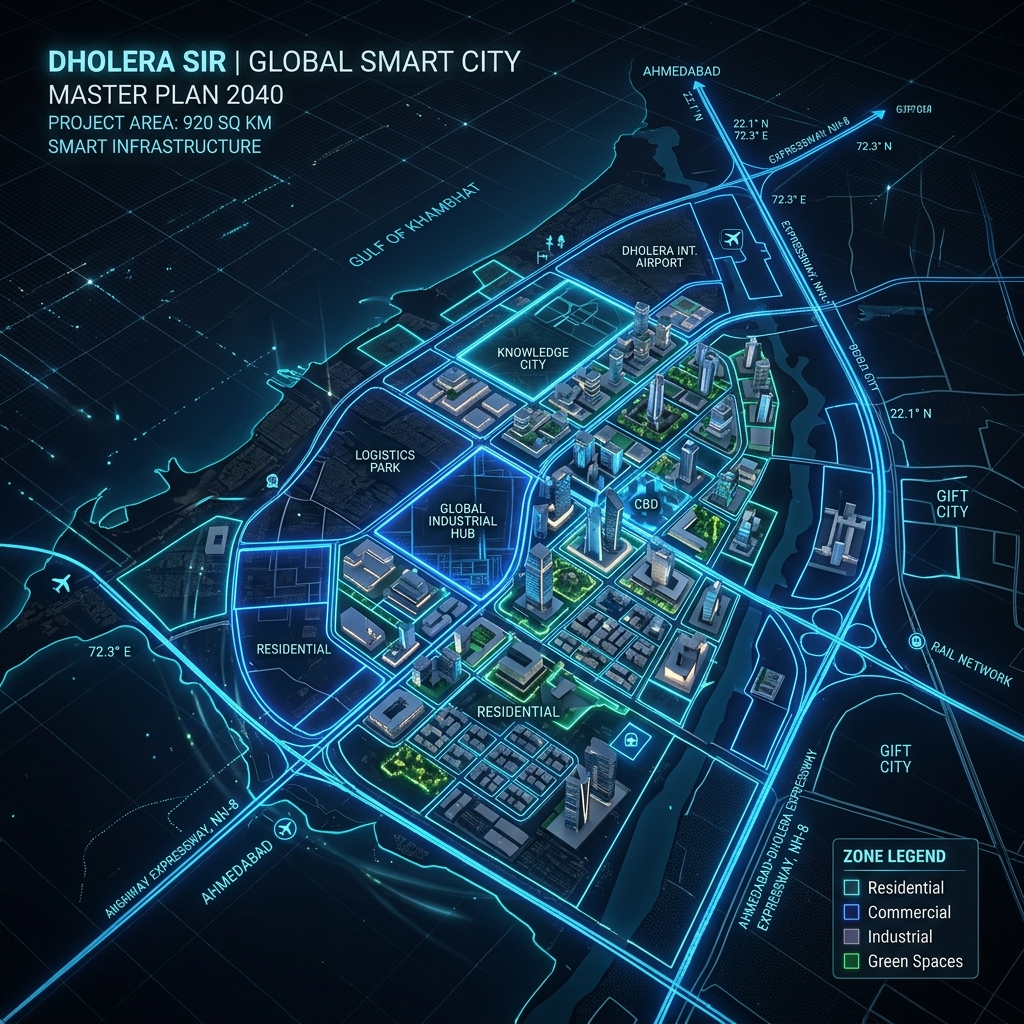

The Structure of the Dholera SIR Development Plan Map
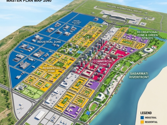
The master development map of the Dholera Special Investment Region (DSIR) is designed as a template for modern smart cities. The 920-square-kilometer region is divided into a developable activation zone and future expansion scheme buffers.
Understanding the geographic layout of these schemes is crucial for identifying high-growth land zones:
- TP Scheme 1 (Activation Area): Consists of 22.5 square kilometers inside the core smart city boundary. All subterranean utilities—such as ICT conduits, sewage lines, potable water pipes, and smart power grids—are 100% complete.
- TP Scheme 2 (Expressway Corridor): Spans the transit routes bordering the Ahmedabad-Dholera Expressway. It features the High Access Corridor (HAC) and mixed-use commercial zones.
- TP Scheme 3 & 4 (Aviation & Logistics Zone): Surrounds the upcoming Dholera International Airport cargo runways. This zone is pre-zoned for cargo sorting hubs, logistics parks, and aviation hospitality.
- TP Scheme 5 & 6 (Heavy Industrial Zones): Located along the outer ring, these zones host large-scale manufacturing clusters, including the Tata Electronics semiconductor fab.
Zoning Specifications & FSI Parameters
The development plan map sets strict density controls (Floor Space Index – FSI) to ensure vertical growth along transit routes and comfortable green spacing in neighborhoods.
| Land Use Zone | Allowed FSI | Min Road Width (ROW) | Max Height Limit | Proximity Focus |
|---|---|---|---|---|
| Residential (Low Density) | 1.0 | 9 to 12 meters | 10 meters | Interior TP1 neighborhood layouts |
| Residential (High Density) | 2.0 | 18 to 30 meters | 25 meters | Arterial transit interfaces |
| High Access Corridor (HAC) | 5.0 | 55 to 70 meters | 150+ meters | Ahmedabad-Dholera Expressway frontage |
| Industrial / Manufacturing | 1.8 | 30 to 55 meters | 35 meters | TP5 & TP6 heavy electronics clusters |
Key Takeaways for Land Buyers
- Verify Reconstitution via F-Form: Reconstitution transforms a raw agricultural land parcel (Original Plot – OP) into a serviced, legal plot (Final Plot – FP). Always cross-reference the FP number with the official DSIRDA Town Planning map.
- Check the Boundary Buffer: Avoid “Dholera Corridor” marketing traps. Verify that the plot’s village falls within the 22 revenue villages officially included in the DSIR development plan map.
- Align with Road Widths: High FSI allocations (like 5.0 in HAC or 1.8 in industrial zones) are strictly dependent on the accessing road’s Right of Way (ROW). Proximity to wider roads increases land valuation.
Frequently Asked Questions (FAQ)
What is the total project area in the Dholera SIR development plan map?
The total planning area in the Dholera Special Investment Region (DSIR) development plan map spans 920 square kilometers, with 422 square kilometers designated as developable land divided across six Town Planning (TP) schemes.
How does FSI relate to road widths on the Dholera map?
FSI limits under DSIRDA regulations are strictly road-dependent. Residential plots on roads under 25 meters are allowed an FSI of 1.0, while plots facing 55-meter or wider roads can scale up to an FSI of 2.0 (residential) or 5.0 (commercial High Access Corridor).
Download Dholera SIR 2026 Investor’s Kit
Get instant access to the official planning documents: Dholera Investment Handbook (PDF), 2026 Land Price List, TP Zone & Village Map, and the NRI Buying Guide.

Join The Discussion